Monday, October 27, 2025

Tamilanadu Road Trip

 Day 1 (16-10-2025)

Vijayawada - Chidambaram

Along with three people I made this road trip.

Reached Chidambaram in the evening and visited Sri Natarajarajar Temple


Day 2  (17-10-2025) 

Chidambaram - Gangaikonda Cholapuram - Kumbakonam - Darasuram - Tanjavur - Rameswaram

Bruhadeeswara Temple in Tanjavur built by Raja Raja 1 in 1010, another Bruhadeeswara Temple at Gangaikonda Cholapuram by his son Rajendra Chola 1 in 1035 and Airavateswara Temple at Darasuram by Raja Raja 2 in 1166 AD are UNESCO World heritage sites designated as The great living Chola Temples. This tag itself tells what they are and how they will be. Those are massive structures with elaborate sculptures dedicated to Lord Shiva.

In Darasuram there are musical steps. A flight of 10 steps that sound 7 Indian musical notes and last 3 steps sound OM. They were now enclosed in a protective cage to safeguard from ruiners.

In Kumbakonam we visited Adikumbeswarar Temple dedicated to Lord Shiva and Sarangapani Temple dedicated to Lord Vishnu.

Reached Rameswaram which lies in Pamban Island in heavy rain and retired for the day.


Day 3  (18-10-2025)

Rameswaram - Dhanushkodi - Tirunelveli - Kanyakumari

In the morning visited Ramanatha Swamy Temple an adobe of Lord Shiva. 

After darshan checked out of hotel to reach Dhanushkodi. This 24 Km long road takes us to the end point of mainland India on Pamban Island. After visiting Kodandarama Temple the journey continues on a road with water on both sides.  When I went last time we were permitted to go into the sea from the circle where the road ends. We roamed for a while on what was believed as Rama Sethu. Now it was entirely closed with wire mesh fence preventing people to enter into the sea. First timers enjoy a lot here.

On our way to Kanyakumari we visited Nellaiappar Temple in Tirunelveli dedicated to Lord Shiva.

It was a massive structure with many mantapas comprising huge pillars with intricate decorations were nothing less than human excellence. Very fascinating. The two pillars in front of main entrance attracted us. They were carved out of monolith and each one was having 48 round sub pillars, which can produce musical notes when we struck on them rhythmically. Vibrant, vivacious and lovely place to visit.

Rain was chasing us like last evening. Reached Kanyakumari at night.


Day 4  (19-10-2025) 

Kanyakumari - Tiruvananthapuram - Jatayu Earth Centre - Punalur

Our plan for the day was to reach sunrise point an hour before sunrise to comfortably accommodate us at a vantagepoint. Rain slashed our ideas. Unable to see anything with thick clouds and rain and had a darsan at Sri Kanyakumari Temple. 

Had a glimpse of Our Lady of Ransom Church. A white, Gothic style structure was a beautiful one.

Checked out of the hotel to reach Thiruvananthapuram to have a long awaited darsan of Sri Ananthapadmanabha Swamy. We stopped at Sai tiffins in Nagercoil for breakfast. Drizzles intensified the beauty of the surroundings. There was a hillock at a distance on which St Xavier's Catholic College of Engineering was established. One of my friends thought about joining in that college for a one-year diploma or so just to enjoy the beauty of the place. We pushed hard to go before temple's closing time of 12 noon. If not, we have to wait upto 5 PM to reopen. Male persons had to wear traditional dress for darsan.

Jatayu was a bird heard in epic Ramayana, fought for Rama, against Ravana during Ma Sita's kidnapping and succumbed to its injuries. Jatayu Earth Centre was constructed on the very place where Jatayu believed to be fallen on a rocky mountain. Hopped onto cable car to reach the top, the only cable car in entire Kerala state. Jatayu sculpture here is world's largest bird sculpture made of concrete. Sculpture is magnificent and worth visiting it. Views from all over the mountain were excellent.

From here our destination was Kodaikanal. A scenic drive. At Punalur we stopped our journey for the day. 


Day 5  (20-10-2025)

Punalur - Kodaikanal

In the morning after breakfast continued to Kodai. Stopped at Erimeli to visit the Temple. Sabarimala route bifurcates here. We went on that route for a while and then came back to join our route. After Erimeli saw so many beautiful Pineapple plantations. Drive was slow because of traffic and drizzles.

Upon reaching foothills of Kodaikanal weather changed to typical "Kodai weather". Weather was exactly as I thought it should be. It was pleasant, drizzling and foggy. Can't see the valleys and hills in the distance because of cloudy weather. Outside temperature was 17 degrees C. Traffic was moving slowly. Taking longer time to clear short distance. Our accommodation was in Pallangi, 10 KM from Kodai Lake, opposite Pallangi falls. We were hearing gushing sound all the night. I enjoyed this ride and the stay.

Day 6  (21-10-2025)

Kodaikanal - Palani - Pollachi

We want to visit some places here in Kodai but rain didn't permit us to do so. So, we began our journey to our next destination Pollachi. Drive was like yesterday till we came on to plains. Another good raid.

Lord Subrahmanya Swamy at Palani blessed us darsan enroute. We went up on foot and came down on Winch car.

Reached Pollachi in the evening.

Day 7  (22-10-2025)

Pollachi - Topslip - Aliyar Dam - Isha Foundation - Erode

Our plan for this day was to visit Top Slip in Tamilanadu and adjoining Devikulam Forest in Kerala. Because of continuous rains forest officials cancelled all safari programs in forests of both the states. Upon our request officials of Top Slip permitted us to go inside. We went up to Parambikulam Forest entrance i.e Anappady forest entry check post, but Kerala officials denied our plea to go in. So went back all the way to see Aliyar Dam. A road beside Aliyar Dam reservoir was leading to Monkey falls and view point and also this road goes to Valaparai another tourist spot. Went up to view point and came back Pollachi, packed things and went to visit Isha Foundation, Coimbatore and then to Erode for the night stop.

Day 8 (23-10-2025)

Erode - Kolli Hills - Chidambaram

Proceeded to Kolli Hills in the morning. To go to the top of Kolli Hills there is a famous winding road with 70 hairpin bends. It gives a thrilling experience to the drivers on mobikes and cars. At 29th bend one can see the road windings. Reached the top and missed a turn to Chidambaram and roamed for a while. Descending Kolli Hills was also a great experience. Stopped at a view point and enjoyed it. Reached Chidambaram in the evening.

Day 9 (24-10-2025)

Chidambaram - Vaiteeswaran Koil - Pitchavaram

Today after visiting Vaiteeswaran Koil went for Pitchavaram boating.

Day 10 (25-10-2025)

Chidambaram - Puducherry - Vijayawada

In Puducherry had a darsan of Lord Manakula Vinayagar and nearby places. Reached Vijayawada in the evening.

Overall it was a great drive. Because of rains we enjoyed beauty of nature during hill raids, especially in Kodai. Journey itself was a bliss throughout.

Tripmeter read 3566 KM

Monday, November 9, 2020

Araku Trip 8-11-2020

 This is one of frequent trips done by my friends on weekends. So we decided to hop on a car on 7th Saturday night. Started a little bit late. Plan was to start at 9 pm but we it was 11 pm.

Morning at 7 we were on Araku road crossing Pendurthi. By seeing a board, Thatipudi Reservoir 7 km, we instantly took that road and reached the Reservoir's surplus vier. Crossed a bridge, constructed across the river, to reach Dam area. Dam was constructed on Gosthani river which originates from Ananthagiri Hills near the famous Borra Caves. This dam supplies water to Visakhapatnam City. An irrigation canal was also there in which we took a refreshing bath. Went on to earth filled Dam to have stunning views, with glorious,calm morning Sun rays, cool breeze filling the soul. As we were following COVID-19 rules, we prepared food on our own. Hear we had sumptuous sambar Idli. 

Next destination was Thatiguda Waterfalls. Route as usual was a thrilling experience. Driving on this winding road with numerous hairpin bends, lush green fauna, Coffee and Cardamom plantations, chilled weather takes you to another level. Took a left from the main road through a local habitation to reach the fall. It was a three stepped cascading fall, flowing flat for a while and jumping down finally.

In our itinerary, next was viewing of valley. Not far from Thatiguda falls road comes Sunkarametta. A Church on the main road was land mark, where we took a left beside the Church, and went through. This route was YHAI's cycling route also with fabulous views. We were lucky to have patches of famous Valise flowers, yellow in colour. Tourists used to come here to see the beauty of the valley filled with flowers. Now a days the local people are not much inclined to cultivate this crop because of monetary issues. The Valley, surrounded by hills, having traces of numerous waterfalls, streams, patches of yellow flowers, hamlets hear and there, humpy roads, clear blue sky, what not, every bit of the drive was crazy. One promises self to come here very often. It takes some time to come out of these feelings.

Proceeded towards Paderu via Chaparai waterfalls. Road was a hell for sometime.Then began a good road. Now everyone was feeling hungry. We were 5 km to Paderu, took a right, went into a scenic road, chose a place to cook our lunch. Filled tummy with delicious food.

Paderu- Narsipatnam ghat road section was bliss to drive. If I compare with Araku ghat this ghat road was best. Enjoyed driving and the trip.

Saturday, November 17, 2012

Talakona

Talakona is situated at about 50km from temple town Tirupati and lies in Sri Vekateswara National Park.There are direct buses from Tirupati or alight at Bhakarapet on Tirupati-Pileru route to reach Talakona which is 20km from Bhakarapet. Last 10 km of travel after Nerabailu village is superb. Along with tourists, so many devotees come here to get the blessings of Sri Siddeswara Swamy, an abode of Lord Shiva.
Talakona is ideal to make a family outing for a day or two. One can stay overnight at C.B.E.T (Community Based Eco-Tourism project) or at T.T.D cottage. Be careful, monkeys are aplenty at both the places. Kitchen staff at CBET prepare any type of food as per the visitor's choice and supply it any where in the surrounding areas. The places of interest here are C.B.E.T, Talakona Waterfall, Appasamy Gundam. So many trekking options are there. One can reach Papavinasam (25 km) near Tirumala from here. Yuddagala Teertham trek (25 km) is another one. Guides are available at C.B.E.T to do all these treks. Don't forget to carry a large amount of water to do these long treks because there are no water bodies present in these routes.
C.B.E.T:
A large densely wooded land is converted into an attractive place with all amenities to the tourists. It has 4 log huts, 2 dormitories, a kitchen, a beautiful dining place and an administrative office. A stream is flowing beside the area. This has a 240 meter long canopy walk at a height of 20 feet. A check dam was constructed to make a tiny  pond on the stream. One can enjoy pedal boating in the pond.
Waterfall:
Fall is 3 km from C.B.E.T. You have to walk past Sri Siddeswara Swamy Temple on a well laid road. At one point road goes down. Take a left here. Instantly you notice a stream. This is the one flowing beside C.B.E.T. Here there is a pond. Path now crosses the stream and you will be walking in a divide of two hills.Stream is right side to you.The 270 ft waterfall first jumps on a rock directly from a solid rock cliff. This is upper portion of the fall. From there it cascades down the rocks and forms the stream. People reach the point where water is landing directly and enjoy taking bath. Just before this point there was path on the left going up. After clearing so many steps there is a T shaped path. On the left you can notice a shed. People take rest here. Take right and go downward at the first bend. Be careful in clearing this steep down hill path to see a stream flowing from left to right. Going left takes you to Appasamy Gundam, a beautiful waterfall with a large pool. To the right of the stream, there is a large long rocky flat area. Usually we camp here at nights. The stream flows beside the rocky area and at the end of the stream it jumps from a rock cliff. Now you are on top of Talakona Waterfall. Usually in day time you can notice so many visitors coming to take bath. On the right side of the flat rock area, there is a path which takes you down to the road. So no need of going back on the same path.This path is on opposite side hill. Here stream flows on the right side. You can see visitors coming to the waterfall on the path you already walked. This can be done vice versa.

Sunday, September 2, 2012

Sudi

Sudi or Soodi is a village in Gadag District of Karnataka.
It has three main attractions.Twin Towered Temple (Jodu Kalasa Gudi), Mallikarjuna Temple and Nag Kunda.
In 1100AD Sudi was the capital of  Kalyani Chalukyas.
I came from Gajendragad (12km) to visit this place. Jodu Kalasa Gudi is beside Gajendragad-Ron State Highway, within a school premises, with an instantly attracting look.
A very good looking twin towered Temple has a Shiva Linga under one tower and the other is unknown. In the common platform between the two shrines a very artistically decorated Nandi was placed facing Shiva. Nandi has its own Panapattam, unlike in so many Temples. On both the sides of Nandi there is a seating arrangement with stone benches. Some of the pillars are standing on those benches. Two ancient inscriptions in Halegannada are lying here. Pillars and outer walls are so attractive.
Mallikarjuna Temple is also very attractive. The entrance doorway of Sanctum Sanctorum  is very nice. This Temple was constructed in 1054.In Mukha Mantapa in the left side there is a Vishnu Idol. On the right Shiva,Parvati,Ganesha and Nandi are standing on a single platform, which is unique.
Naga Kunda is a tank with beautifully carved inner walls. The pemises of Nagakunda has many attractions. Two big Lingas are there. One is under the roof and the others roof is missing. Nandi is under a shelter. A stone carved Maha Ganapati is in another structure in a corner. The statue is nearly 8 feet height. Beside this structure a Halegannada inscription was planted on a platform.
Itagi Bhimambika Temple is 4 km from here. I visited that Temple also.
Photos

Wednesday, August 22, 2012

Ahobilam


Ahobilam is in Kurnool District of Andhra Pradesh. The principle deity in the Temple here is Lord Narasimha an abode of Lord Vishnu.Usually Ahobilam means lower Ahobilam. Upper Ahobilam is 9 km from lower Ahobilam.
The Temple in Lower Ahobilam is a gigantic one with lot of art work on rock, which is really a feast for eyes.
Altogether there are nine Narasimha Temples in Ahobilam area. They are called Nava Narasimha Temples.
Ahobila Narasimha Temple:
Upon alighting at Upper Ahobilam, instantly a tiny, beautiful "U" shaped water fall attracted our attention. After a flight of steps along the dormitories Ahobila Narasimha Temple will be visible between two hills. Left side hill was more scenic with waterfalls. The right side hill was cut for some extent to make a flat area and the Temple was constructed in that place. At the left side of the ground there is a stream which is making the "U" shaped fall. 
We first had darshan of Lord Ahobila Narasimha. To the left of the temple along the stream, there is a way, which leads to the back side of the Temple. Here the path bifurcates. The straight one from here goes to Varaha Narasimha Temple along the stream. The path to the right that goes from back side of the temple goes to Pavana Narasimha Temple, which is 7 km from here. On the right side path there is only one Temple, Pavana Narasimha, but on the left side hill along the stream, there are Varaha, Jwala and Malola Narasimha Temples. So after visiting Pavana, we have to come back all the way and visit the other three Temples on the left side. All together there are five Temples in this area.
Pavana Narasimha:
We opted to visit Pavana Narasimha Temple first. Initially we cleared so many steps and then we walked on a well marked road. Not only this but path to every Temple is well marked. Malola Narasimha witch was seen in the dense vegetation on the slope of opposite hill was superb. This entire stretch of 7 km goes under the shade. Surprisingly, Tamil devotees were high in number than Andhrites. We noticed only our batch were the local state people going to Pavana. Pavana Narasimha temple is in the midst of green hills.It has another route which can be accessed from Lower Ahobilam on motor vehicles. It is a whopping 25 km kaccha road. Had darshan of The Lord and came back on the same way.
Varaha Narasimha:
From the point where we took left from the back of the Ahobila Narasimha, go straight along the stream to reach Varaha Narasimha. Visited the Temple and went on crossing a bridge on the stream to reach Jwala, then Malola. Here there is a path just before Varaha to reach Malola first and then to Jwala depending on your choice.
Jwala Narasimha Temple:
We again crossed the stream after the bridge and went along with it for a while, which is very scenic. Walk itself was a pleasure here. Soon we saw a bridge across the stream and went up. From here path was continuously up hill made beside the hill slope and going round along a gorge. The gorge is exactly " ? " shaped. Now Jwala Narasimha Temple was exactly in our opposite on the other side of the gorge. In between there is a waterfall. Devotees were soaking in water when they were crossing it. When we crossed the waterfall, Sun was in such a position created a rainbow on the splashed droplets of water that jumped on the rocks. Devotees had a whale of a time at the waterfall. Had darshan of Lord and came down to the bridge area. This is the junction point. Devotees coming from Malola and Varaha meet here. Here our guide showed us Fierce Pillar (Ugra Sthambham) beside the waterfall on top the hill, which was believed to be the Mythological Pillar from where Lord Narasimha emerged, to kill Hiranyakasipa, the demon king. It can be accessed from the waterfall area. We didn't go there. We were on our way to Malola Narasimha Temple.
Malola Narasimha Temple:
From the bridge area the path is stepped at some stretches but a pleasant one. There are names to the faces of the hills in our opposite direction. Guide explained why they got those names. After visiting the Lord we headed to Ahobila Narasimha. Thus we visited five of the Temples. Had a sumptuous lunch at a dormitory and began going down to visit other Temples.
Karanja, Chatravata and Yogananda Narasimha Temples:
All these are accessible by vehicle during the ride to Lower Ahobilam. But Bhargava Narasimha Temple which we missed to see is at half an hour distance from Lower Ahobilam Temple in the forest. Bhargava closes at 5 in the evening. We reached lower Ahobilam at 6, so it didn't happened for us to visit.
We made all this in one day. Had we reached Upper Ahobilam before six in the morning, we would have visited Bhargava Narasimha Temple also.

Photos    

Friday, July 27, 2012

Badami-Sidlaphadi-Mahakoota

18-12-2009
Sidlaphadi is a cave, that housed  the prehistoric man. It is near Badami.
I heard about this just before my visit to Badami. So i decided to have a look at this place. First day I saw Badami Caves, Temples and Fort. At cave area there were so many guides. I hired a guide for tomorrow to reach Mahakoota Temple from Badami via Sidlaphadi.
In the morning after breakfast, we moved on Bagalkot road to reach Hotel Badami Court, a little far from the town towards Railway Station. Just after the the Hotel there is a track going up towards the hill. We took that trail and walked toward a Mobile Phone Tower which was seen on a hill. Now a days Karnataka Tourism Corporation people nailed a sign board beside the road showing the way to Sidlaphadi. A power transmission line is going along with the route, up to a Mobile Phone Tower. Road was pebbled and gravel one. Crossed Mobile Phone Tower and walked further to reach Sidlaphadi. On our way there were some curious rock formations looked like igloos.There was a  descend at the end of the road into a U shaped gorge between two hills. Here we saw a unique rock-formation during the descent. It was an hour walk from the main road.
The cave looked like a big arch, placed on two rocks on both sides,with holes on its top. Locals say they were caused by lightning. So it was called Sidla-Phadi. Thorny bushes were present on the ground here and there.This place was the home to the humans Millions of years ago. Spent some time here to inspect the cave. There were some more caves in its vicinity.
Archaeological Survey Of India conducted research here. They found some Neolithic Pottery and microliths. A replica of Sidlaphadi is seen in ASI Badami Museum.
An hour of walk took us to Mahakoota Temple. We reached the Temple by a steep descent from top of the hill.
Mahakooteswara is the principle deity in this Temple, an abode of Lord Shiva. This Temple was built by Chalukya Dynasty in 6th century AD. The main Temple is highly decorated mainly with Shivapurana stories. Here there are two tanks.One is inside the Temple and another one is outside. Both the tanks are fed by perennial streams. Water oozing is not visible in both the tanks. But you can notice water going out of the inside tank into a canal through a surplus weir. Pilgrims usually take bath first in the outside tank and later inside and go to darshan. The Temple has  nicely kept old charm. There are so many sub shrines within the Temple premises. Some Sub Shrines are constructed in Nagara style. They believed to be constructed on later date. Some of the Sculptures are awesome. Ardhnariswara image on one of the Temples beside the inner tank was fabulous. Ficus trees are every where to give good shade. Every one will be in a state of fulfillment by the charm and grace of this Temple.
I recently visited Mahakoota (13-01-2013). A renovation work is going on inside the Temple premises. Authorities removed some sub shrines to reconstruct.
Photos

Mahadeva Temple, Itagi

Mahadeva Temple, Itagi is in Koppal District of Karnataka.
Ever since I visited this Temple, I assume myself as a lucky guy. Because this Temple was a finest piece of example for an artistic sculpture. It was built by Mahadeva, a commander in the army of Vikramaditya VI, a Western Chalukya King, in 1112 AD.
The first look of this Temple from far of an area gives an impression that you reached a remarkable place. The entrance takes us to eastern most open mantapa with so many artistically decorated pillars. It has a dome at the center. The pillars that are hanging from the dome leaves you speechless. We can see immaculate display of craftsmanship in shaping the Pillars. Never I have seen that type of artistry before. Look up into the dome, you will find a lavish sculpture. Not only in this one, but in every one.Overall there are 4 domes. This East faced Temple comprises 68 carved pillars, columns and decorated walls with doors on North and South. All the doorways are fashioned in surprisingly beautiful style. The magnificence and exquisitely carved decorative details of this Temple are the finest example of  Chalukyan Architecture.
This high towered Temple has a cluster of many Temples in its premises. An inscription in this Temple in medieval Kannada states this Temple as "Emperor Among Temples".
Photos

Wednesday, July 25, 2012

Seshachalam Trek

Year: 2006
This trek was conducted by YHAI Andhra Pradesh State Branch.
I came into contact with state YHAI officials after my Har Ki Doon trek. For this trek I reported at Tirumala. As soon as the flag off ceremony we reached Papavinasam Teertham. Crossed Papavinasam Dam after showing permission letter. YH Tirupati unit arranged all those formalities in advance. We soon entered in to greenery. First reached Sanakasananda Teertham. It is believed 108 Teerthams are there in Seshachal Hills. Teertham is a pond where one can take a holy dip. It's all like taking bath in Kapila Teertham in Tirupati. But In Sanakasananda there was no sufficient water to have a dip.
We headed for Ramakrishna Teertham. Unlike other treks, here porters were carrying utensils and groceries along with the trekkers. So there was no need to pitch tents in advance and prior arrangements. After porters reaching a designated camp, cooks started cooking, mean while trekkers were taking some rest.
There are two foot path routes to reach Tirumala from Tirupati. One starts at Alipiri and another starts at Srivari Mettu near Srinivasa Mangapuram. But this route starts from Kukkala Doddi in Kadapa district which is on Renigunta -Kadapa highway. People from adjoining places opt this route to reach Tirumala.
Ramakrishna Teertham:
1.5 km after Sanakasananda, trail reaches a stream. This is the junction point of Ramakrishna and Tumburu Teerthams. Crossing  the stream and following the trail takes you to Ramakrishna Teertham (1.5 km) and continuing along the stream for a while and following the path takes you to Tumburu Teertham. Entering Ramakrishna Teertham opening was a thrilling experience.Trekkers were disappearing into a hole covered with branches and leaves. I also entered to discover a deep down hill path studded with huge boulders. Some of the boulders were knee high and some were more than that. At some places ropes were tied to sticks and ladders were fixes to ensure the safety of the visitors. That maneuver went on for 40 minutes. At the end there was a big ladder to enter into a flat rocky area which we used as a camping ground for the night.  A stream was emerging from one corner, dividing into so many canals on the flat rock area. At the end all were united to make a single fall making a pond. That was Ramakrishna Teertham. We went down to the pond and had bath.
In the night after dinner it was campfire time. Enjoyed it. In the morning took bath another time. Left to Tumburu Teertham on the same path. It took nearly 50 min to reach the top. From there it was 1.5 km to the junction. Visiting Ramakrishna Teertham was a nice experience.
Tumburu Teertham:
It took 3 hours to reach Tumburu Teertham from the junction. Just before reaching Tumburu, there was a pond with crystal clear water with a depth of 5 feet. One or two guys jumped into it. Underneath stones were clearly visible. A marvelous sight. Just after this pond we saw a cave. Some people ventured in.
We put all our belongings beside a stream which would be our camp site for the night. Here also there is a cave. It is believed Matrusri Tarigonda Vengamamba, a poetess, an ardent devotee of Lord Venkateswara, made penance in this cave.
Here there is an amazing geographical wonder. We went along the stream. After a normal walk within the stream, there was a long deep pool. Then started the magic. We were now walking in a crack of a hill. The crack formed a deep, long  gorge of about 300 m long, 25 m high, 10 m wide gorge. Stream is flowing at the bottom of the gorge, which had so many jacuzzi type pools and a waterfall at the end. What a thing! So many people were in awe.
In the morning I went up to the crystal clear pool along with two others to take bath and thoroughly enjoyed.
Bandi Irusulu Teertham:
As we were in the middle of the forest and surrounded by hills, we were unaware when it clocked 8. After a photo session we moved along the stream. We began moving inspecting the surroundings, the leader stopped us to have a stare at the paintings that were believed to be painted by ancient man. Scientific experiments revel they were painted 10,000 years back. All curiously inspected those figures. Some even touched them. Sanyasivani Gavi (an ascetic's cave) came within a km of walk from the paintings in a open area that surrounded by hills with large trees. Many people went in crawling. There was room for only one at some height from the ground in one cave. May be it was made like that to ensure the safety of the occupant from animals, I believe. But another cave beside that was larger compared to the previous one. It was easily accessible. Walk entered into a rivulet studded with medium sized boulders. Before entering the rivulet, one of the organisers showed us a pug mark of a leopard. Shutter bugs immediately went into action. Here there was another attraction. The hill slopes on the other side of the rivulet were very smooth. On the smoothy areas there were some marks. It is believed those were also made by ancient people that lived in that area. When those people sharpened their arrows, those groove like marks remained on the hills. The rivulet was large initially and it became narrow afterwards. We passed Pagadimanu Gundam in no time. A 2.5 km boulder hopping took us to Chakalibana Teertham, which I consider as a beautiful waterfall, with a right side detour. Surroundings were also great, especially the upstream area. A guy went up and appreciated its beauty. I told so many people, who were participating, not to miss that view. Half a km from here we reached  our camp sight Bandi Irusulu Teertham ( axle of ox cart). Water in this Teertham was very clear and refreshing.
In the morning, after another refreshing dip started to come back into "our" world. Passes Pyramid Hill (named because it looked like Pyramid) and Pandi Gunta (Pit made by a wild boar). In any given time there will be water in this pit. In one summer there was no water available to drink in the forest. A wild boar furiously dashed the earth that made a pit. Instantly water emerged from that pit. This was the story behind that. Took lunch at Balapalle Forest Guest House. Reached Kadapa-Reigunta Highway to catch the bus.

Tuesday, June 5, 2012

Me


Hi
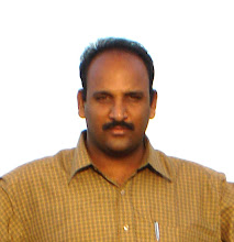
I am Ratna Prasad Ravi. But I am familiar with my nickname Nani. The photograph on the left was taken when I was on my mother's lap. The other one was taken in 1990. Now you can see myself with a bald head.
My Ideology:
Many experts predict India may become a super power in the future. Some said (In 2000) it will become in 2020. We are now dragged into 2012, and I see no ...............Why?
I think to become a super power a country has to be self sustained in so many areas especially in defense. Living standards of its citizens play a major role in calculating it. Economically the country should be sound. Should record a good Industrial growth. Where is India in all those areas?
1) Defense:
Still looking for vendors for arms, ammunition, fighter planes, bomber jets and submarines.
No one knows when it will get Blue-Water naval capability.
2) Public Health:
Worst of all
a) About 15% of worlds Leishmaniasis patients are in Bihar itself.
b) Accounts for 1/5 of world TB patients.
c) India is home to the world's largest number of blind people.
d) It has a single highest share of neonatal deaths in the world.
e) Reported as having highest rate of rabies deaths in the world.
f) Makes up 58% of world population which still practices open defecation.
3) Agriculture:
a) India is the largest producer and consumer of pulses in the world(2011). To meet the demand it is importing 3 million tons(2011) of them. Productivity is 637 kg/ha. Global average is 871 kg/ha. So no self sufficiency.
b) Largest producer and consumer of milk yet neither exports nor imports
c) India had the largest farm area of paddy production. But India is the second largest producer of the essential staple food Rice (China stands first and Indonesia third). Farm paddy productivity in India were about 45% of China's and 60% of Indonesia's. If India could adopt the paddy farming knowledge and technology in use in China and Indonesia, it can produce 75% higher.
4) Electricity:
Load shedding is a very common factor in India. Each and every Indian knows where India is in this sector. No one knows when it will become self sufficient in this area.
5) Social:
Social inequality is another factor which is much more alarming. If politicians continue their rogue politics like this Indian society may not be like this. Social divide will be wider and there will be clashes between people.

Collapse of the USSR was the beginning of the end of world peace:
After World War II The USSR and The USA were emerged as Super Powers. The USSR and its allies  Eastern Bloc and The USA and its Western Allies were always engaged in duel with each other. The USA came up with a mutual defense treaty with its allies called NATO forces. The USSR  came up with a similar treaty with its allies at Warsaw, Poland to form Warsaw Pact Forces. So USA and USSR took the responsibility of their allied country's security and sovereignty. After the collapse of USSR, the Warsaw pact countries felt unsecured and felt they have to secure their position on their own. So, arms race began at this point. Some of the countries even worked for nuclear devises to threaten the US. US now a days is not so peaceful than it was in the days of cold war (1947-1991).
Future of US:
I see no threat to the US position as a strong nation in the near future. People all over the world like to settle in the land of opportunity like ever before.
Future Bombs:
Since from the existence of humans on this Earth, the strongest is the winner, when they were single or after forming a society and colony or in kingdoms or after transforming into the current system of country hood. Who was having more destructive power than others was agreed to be their leader. Most of the Asian and African sects fought Europeans with arrows and swords, while the latter were using guns and cannons. Entire world went into their hands, because of their mass killing power. Now also the thing is same. In the future also it will be the same. The nation which is having more destructive power than others, like nukes in greater range, rules. In the future US may develop Genom Bombs. They can wipe out entire humans of particular race they wish to destroy.

In my life:
Usually every one come across some curious things in their life time. I also.

1) Man set his foot on Moon in 1969.
2) Mobile Phone: Developed in its present form in 1973, this technology, I consider, as revolutionary in the entire history of mankind. No other technology has this distinction. It penetrated into the life of humans like it were the part in their body.
3) Concorde Plane: Considered to be an aviation icon, this supersonic transport plane was a favourite to so many in their life time. Commercially started in 1976, retired in 2003, this marvelous technological giant still has an unsurpassed technology. It retired long ago, still it hasn't had any alternative.   
4) Launch of space Crafts Voyager 1 and 2 in 1977. In 1998 V 1 became the most distant man made object ever sent from Earth. Probably V 1 by 2014, may become the first object that sent from Earth to become an Interstellar Spacecraft.
5) In 1978 first "Test-Tube" baby was born.
6) Space Shuttle Program: Started in 1981 and ended in 2011. Witnessed a paramount technology.
7) Internet. Nowadays people can't think of their livelihood without this. Born in 1983 in its present form it brought magic and it is considerably greatest technology that influenced human life.
8) In early 1986 Halley's comet visited our inner solar system and it will again come here in 2061 
9) In 1997 Comet Hale-Bopp was seen with the naked eye from the Earth. It was calculated that Hale-Bopp came to inner solar system previously was in July, 2215 B.C. It is predicted, it will come back in the year 4385.
10) In 1998 Comet Tempel-Tuttle came and it will re appear in 2031.
11) I saw the beginning of a millennium.
12) The most shocking incident I ever felt was the collapse of Twin Towers.

Cricket:
As usual like all Indians I was a die hard fan of this game until fixing charges surfaced. Now I pay a very little attention towards this game.
Now a days bowlers forgot about 3 B's ( Beamer, Bumper and Bouncer) and became run giving machines.

Saturday, October 8, 2011

Temples In Diviseema

What is Diviseema?
Diviseema is an island lying at the mouth of River Krishna.
River Krishna branches off into two arms at Puligadda and joins Bay Of Bengal forming an island, "Diviseema". One branch, the smaller one, joins the sea at Sagarasangamam in Hamsaladeevi village. The other branches off further before joining the sea at Yetimoga forming two more islands called Yedurumondi and Nachugunta.
Diviseema has rich cultural heritage and having many ancient temples. My native place Ravivaripalem falls in Mopidevi Panchayat, lies on the bank of the smaller arm of River Krishna. Earlier, a low level 1936 built road cum aqueduct on the smaller arm connecting the island with the main land used to be submerged when ever there were floods, cutting off the island with rest of the district. Now a high level bridge was constructed on both the arms of the river after Mopidevi as part of NH 214A (Digamarru-Ongole) is catering the transportation needs of the island, became the lifeline of the area. Thenceforth, the aqueduct was closed to road traffic. The rich historical heritage of this area was enticing me from so many days. So I fulfilled it by visiting some of the Temples of the area on the festival day of Dasara (6-10-2011).
Route:
Ravivaripalem-Avanigadda-Viswanathapalli-Koduru-Hamsaladeevi-Vullipalem-Koduru-Bhavadevarapalli-Sangameswaram-Barrenkula-Ganapeswaram-Nangegadda-Avanigadda-Ravivaripalem
I started at my home at 5.30 a.m. Reached Viswanathapalli first to take the blessings of Addanki Nancharamma Talli, The Eternal Mother. I visit this temple very often. It was calm and silent in the morning. But on annual festival day the scene will be different. Thousands of people, along with their vehicles and cattle, throng in the village, move in a line to have darshan of Maa Nancharamma. People come from neighbouring districts too.
Hamsaladeevi
:
Hamsaladeevi is having a famous Lord Venugopala (Abode of Lord Vishnu) temple and also this is the place where River Krishna confluences with Bay of Bengal. To reach the point of merger one has to travel a further 5 k.m via Palakaya Tippa village. Villagers belive that this Temple was built in only one night by Angels. During 1977 hurricane a large number of people made it a safe place. As they thought, it withstood the killer tidal wave by making so many people live. Ancient inscriptions are there on the pillars of mukha mantapa.
Vullipalem:

This village lies in between Hamsaladeevi and Koduru. Here Srimannarayana Swamy Temple is famous as it is claimed to be the only Temple of his holiness in entire Andhra Pradesh. Temple was under renovation. Deities were in a temporary structure. The old Temple was constructed 100 years ago by a seer came from Melkote, Karnataka, the place where Srimannarayana Swamy Temple was there ages ago. Temple will be ready by February 2012.
Bhavadevarapalli
:
The name itself was derived from the name of Bhavanarayana Swamy (abode of Lord Vishnu), the principal deity of a big temple here. Temple has a high, nicely carved steeple and a fine garden. Entered into the front porch after a circumambulation. It seemed old but beautiful. It opens into mukha mantapa. Lord Bhavanarayana Swamy was there in the sanctum sanctorum adorned with so many flowers and garlands. Blessed me a great darshan.
Usually I inquire about the history of the place with the priest, when ever I visit a temple. This temple is one of the Pancha (five) Bhavanarayana Swamy Temples in the state. The others are Ponnuru, Pedaganjam near Ongole, Sarpavaram near Kakinada and Pattiseema near Rajahmundry.
Sangameswaram
:
This place is few kilometers from Bhavadevarapalli via Kammanamolu. The road leads straight to Sri Sangameswara Swamy Temple (abode of Lord Shiva). Priest was performing puja. This temple is an architectural marvel to witness Sun rays directly falling on Shiva Lingam during the period of March 4th to 20th every year.
Ganapeswaram:

The Temple in this village was built in 1231, in the honour of Ganapatideva, great Kakatiya King of Warangal (1199-1269), by Jayapa Senani, his CinC of Elephant corps.
The deity in the temple is Sri Durga Ganapeswara Swamy (abode of Lord Shiva). There are separate temples for Maa Durga and Sri Ganapeswara swamy in one premises adjacent to each other. There is a big circumambulatory round around the temples together. Pilgrims were entering the premises, completing the circumambulation on the vehicles they came, parking them a side and going into the temple. Priests were busy performing puja in Maa Durga Temple. Huge crowd of pilgrims was there. At the entrance of Durga Temple there was an ancient inscription studded on a pillar.
Jayapa, I consider, as the greatest person hailing from this area. He was a man with many faces. He was Commander- In-Chief of Elephant forces in Orugallu King Ganapatideva's court. Ganapatideva honoured Jayapa with the title"Vairigodhuma Gharatta" for the services he rendered during Kalinga War. He wrote a book "Nritya Ratnavali" on Indian Dance during 1253-54, in Sanskrit, first ever book of its kind on dance in Indian Literature.

Tuesday, February 1, 2011

Cycling

I do cycling most often in surrounding areas of Vijayawada.

Route #1

It's a 45+ km ordeal around Vijayawada. I start from my home at Poranki and cycle 14 km to reach Gunadala. Another 6 km of cycling takes me to Nunna. 8 km is the distance between Nunna and Ambapuram which is on Vijayawada - Mylavaram SH. This stretch is the scenic of all stretches. Road goes along Mango and other fruit gardens. In Ambapuram village a rock-cut Jain Temple is situated on top of a hill. Path to this temple starts from the middle of the village. I visited it twice. I reach Inner Ring Road (IRR) just after Ambapuram. Here route bifurcates. Choosing to go on IRR takes another time to Gunadala thus reaching Poranki. Or continuing further on Milk factory-Kaleswara Rao Market-Police Control room route lands me on Bunder Road, to continue to Poranki. This encircles the city.

Route #2

River side biking to Amaravati. This is a route with amazing views.

Route #3

Vijayawada-Undavalli Caves-Krishnaya Palem-Yerrabalem-Tadepalli-Vijayawada

There are two Dhabas serving yummy vegetarian food on Mangalagiri-Tadepalli route in Yerrabalem village.

Friday, January 14, 2011

Amaravati

Date: 11-1-11
Amaravati is a pilgrimage and historic place about 40 km from Vijayawada City. This is one of the most important Buddhist sites in Southern India.
It was the capital of Satavahanas, the first great dynasty of Andhra Kings, ruled between 2nd Century B.C to 3rd Century A.D.
I visited this place twice before, along with my friend Ramana Babu initially, another time on a cycling trip and now with my family. Both the places Amaravati and Vijayawada are on the banks of River Krishna. Vijayawada is on left bank and Amaravati is on right bank. There are two routes to reach this place. One is conventional bus route and another one is an ancient narrow river side road on western levee. On all occasions I chose the latter because it goes through some of the scenic places. These two routes join at Harischandra Puram. On two motor driven bikes we started our journey in the early morning to the place which has 2200 years of history.
We crossed River Krishna on Prakasam Barrage and at the end of it took right to cross Krishna western canal head sluice and joined the road that laid on levee. Journey on this road was a bliss. Since the road was elevated, we had a vivid view of surrounding fields. Land was very fertile here. We traveled through Jasmine, Chrysanthemum, Banana, Turmeric and Indian Corn plantations. Since the road was laid long back it was having a lot of chuckholes. Seemed comfortable for two wheelers ride only, forced four wheeler traffic to a halt, thus making an idyllic ride.
Surroundings between Harischandra Puram and its neighbouring village Vaikuntha Puram were marvelous. Though a smaller one, Venkatesh (My eldest son) enjoyed ride a lot on this stretch. Lord Venkateswara Temple is there on a hill in Vaikuntha Puram. People park their vehicles at another temple at the foot of the hill and begin trekking to reach the temple. River Krishna flows beside the hill. Devotees enjoy a good panorama here. From this place Amaravati is visible at far of a distance. I visited this temple during my cycling trip.Reached Amaravati and headed straight to the Temple.
Temple is on the right bank of River Krishna. Some of the devotees were bathing there. Took darshan tickets and entered into massive temple complex. The Temple was on an elevated platform with high raised walls. That might be built to safeguard the Temple from River Krishna flood waters during monsoon season. Cleared steps to enter on to circumambulatory round the main Temple. On each corner there was a peripheral sub-shrine. Lord Amareswara is the presiding deity here, an abode of Lord Shiva. Entered into the Temple from East entrance gallery. Columns of the gallery were consisting old Telugu inscriptions. At the left side of the entrance there was a large Lord Ganesha's statue. Lord Amareswara blessed us his darshan. We moved on to reach Archaeological Survey Of India museum.
Museum:
This little Museum stores some of history's most treasured Buddhist relics collected from nearby Maha Stupa. This area was an exponent of Amaravati School Of Art. This School finds adequate mention in the chronicles of The Satavahana era. The exhibits here range between 3rd Century B.C to 12th Century A.D.The Lotus and Purnakumbha Motifs, the sculpting and the art forms that once upon a time adorned the ancient Buddhist Mahachaityas are displayed in the Principal gallery. Drum slabs, Swastikas and relics of Jataka Stories occupy first gallery. The second gallery is dedicated to life size image of Gautama Buddha.The other Buddhist sculptures that were excavated from here now adorn the Chennai Museum and at Room No.33a of The British Museum, London.
The Museum remains open all through the week from 10 a.m to 5 p.m. Entry fees is Rs.2/- per visitor above the threshold of 15 years.
Maha Stupa:
The road beside The Museum took us to this place. Colonel Colin Mackenzie discovered this remains of The Stupa in 1797. There after so many Archaeologists worked on it.
Only remains of the Stupa are existing. It was defaced at large by the locals before this was taken over by the Authorities. Locals say so many large bricks used in the construction were lifted from here to construct their houses, thus history became history. The British and Indian Rulers also did their best to make this priceless monument convert into tiny objects of exhibition in the galleries of Museums across Europe and India. The artefact's still remained were kept in the local Museum. Replica of this Maha Stupa is in the local Museum.
Kalchakra 2006 was performed here. Interestingly Lord Buddha taught the first Kalachakra root tantra here in Amaravati to King Suchandra up on his request that would allow him to practice the Dharma without renouncing his worldly enjoyments and responsibilities.
On the eve of Kalachakra 2006, authorities reconstructed Stupa and took up Dhyana Buddha Project scheduled to be opened at the time of Kalachakra which can be seen from this site, a kilometer away, still to be completed. We visited that and continued our journey back this time on Bus route to visit Undavalli Caves.
Undavalli Caves: The Caves are just 8 km from Vijayawada. The caves were sculpted in 2nd and 3rd century A.D. Caves are four storied and built in a cluster. In one of the caves we visited Sri Ananta Padmanabha Swamy, an abode of Lord Vishnu, a 5 meter long reclining statue carved out of single granite block.


Other Buddhist sites that can be covered from Vijayawada are Ghantasala and Jaggaiahpeta

Tuesday, December 28, 2010

Gulbarga Fort

Date: 28-12-2010
Today I chose to tour Gulbarga City. Reached there from Yadgir (Karnataka) on train(on Chennai-Mumbai rail route). Called once as Ahsenabad during Bahmani Sultanate period, now as Kalburgi in native language Kannada has its own culture and heritage. I visited Gulbarga Fort and Khwaja Bande Nawaz Durgah.
Gulbarga Fort was known to be built by Raja Gulchand of Warangal. It served as Capital of Bahmani Empire during 1347 to 1424 AD. This fort consists around 75 acres and 2 rounds of fortification. The outer wall is of lesser height and the inner wall is slightly higher and also had a moat around it. It has 15 bastions and 26 cannons. Most of the fortification was in a ruined state and encroachers were living happily in side the fort with full amenities.
I entered in to the fort through east entrance. There was a tallest stone built structure within a close distance from the entrance. A bifurcated path was going beside that structure from the entrance. Another one was leading towards Jumma Masjid. The stone built structure was 50 feet height with raised walls on all 4 sides and having an array of steps that were covering half of it's height at one corner beside the path, were leading inside. At the end of the steps there was a huge open top space still covered with walls on all sides. Up to this it was basement area. Open space area was only 1/5th of the total structure and the rest of it on the left side was further heightened. There were some openings to the left side wall, but they were sealed off with stones. At the other end of the floor there were another series of steps leading to the top. Atop there were 3 cannons placed strategically. So this must be a security post. From its top stared the most of the destroyed fortification, Jumma Masjid and another security post at a distance with a big cannon.
Came out of it and walked towards a bastion. On the way there were houses. People in those houses were not happy as I was inquiring about the path that was leading to the bastion. They were telling there was no way. But at last they agreed to go on. Thorns were lying in large on the path. It looked like officials cleared all the bushes. While I was approaching bastion a guy called me and yelled don't go. I told him to come there. He came and said, don't go up. It's a dangerous place. A wrong foot will make you collapse, like that. But I continued and asked him to come along with me. There was cannon on that bastion. I asked him about the cannons on other bastions. He told some were missing. Came down and marched towards Jumma Masjid.
This was a great mosque that can accommodate about 5000 worshipers at a time. It was built by an architect Rafi from Iran in 1367. Masjid is supported on 140 pillars. It has 250 arches and 5 large domes. The central dome was 80 feet in diameter and its interiors were decorated with flowers and creepers. There were 63 smaller domes also and they look like pots up on the mosque. This mosque was said to be fashioned on the lines of the famous Mosque of Cardova City in Spain. This was a silent place except for some chirps and tweets. Sat there in silence escaping urban chaos for a while.
Came out of Masjid, walked toward another security post in the fortification. This post was round and has 29 foot cannon, longest in this fort's artillery. Both the security posts were on same line. Walked along fortification until I had a all dome view of the Masjid. From the back also it has an attractive appearance. Except in the three structures area, everything was untidy. One can't even walk along the fortification. Path was full of thorns and human excreta. It seemed a few days ago authorities or care takers of the Fort or may be encroachers might have cut all the thorny bushes. So that I could have roamed here and there. Otherwise I wouldn't have made that adventure. At some places there were tiny passages in the inner fort wall to reach outer fort wall. Earth was filled to the wall height all along the inner fort wall, might be because it would be a repellent to enemy artillery.
Impression: The fort before decades was in ruining stage. Because there were no care takers. But nowadays everyone is there and all are allowing the fort to ruin in a rapid pace. Some of the places in the fort are not accessible now, thanks for the people who were residing in peace, happily erasing nearly thousand years of history. Archaeological Survey Of India washed its hands by putting a "trespassers are prosecuted" like thing. It seemed the fortification was being defaced in large in the last two to three decades time. This great fort withstood nearly for a millennium against all odds like wars, conflicts, change over between dynasties, unnoticed during British rule, face lift afterwards and now it is fighting for its existence in this peace time.


Photos

Monday, November 22, 2010

Jujjuru-Mulapadu Trek

Date: 21-11-2010
Today started our trek an hour behind the schedule at 10.00 at Jujjuru. As we reached the destination our guide and one helper were waiting at designated location. Started walking toward hills through our co-trekker Mr.Nagabhushana Rao's Subabul plantation. Nagarjuna Sagar Project Canal was flowing beside his field. Crossed it to enter in to reserve forest. Within 10 minutes we reached foot of the hill and began ascending. At 100 meters of ascend we heard noise of water flow. After another 100 meters there was a path leading to the stream.We deviated our path to have a look at that. Spent some time here and moved further in the path to reach another deviation toward the stream again. After a brief interval moved to cross the stream.Started again and met 2 persons who left their cattle in the forest. The cattle remain there for the next 3 months. Up to here path was boulder studded and steep uphill. From this point trail was flat. Here we contemplated what our next course of action would be with the guide for a while, about various options like what are the destinations we can reach from that place. He told the team can reach Kondapalli. We were happy to hear that. This was what we were looking for since long. Entire Vijayawada trekker's team was looking for this moment. This trail Jujjuru to Kondapalli is an end to end trail upon the hills in Kondapalli Reserve Forest Area.
Entire team was now on a brisk pace to reach the destination. Eventually we came through some beautiful locations en route. At 2.00 we stopped for our lunch beside a stream.
After a brief walk from lunch point we reached Mulapadu Hanuman temple. En route we spotted spiders of robust size. Are they dangerous? Guide said no. Right from the beginning up to the temple we walked under the shade of trees. Rains were abundant this year, so greenery was plentiful. Today is Kartika Punnami. An auspicious day, on this day annual temple mahotsavam was organised at Hanuman Temple. A large number of devotees were present. After hectic conversations Ramdas decided to cut short the trek to reach Mulapadu village. We came to know Mulapadu village on N.H 9 is 11 km from the Temple. Reached N.H 9, crossing Mulapadu village at 7.00 in the evening. Ramdas noticed a stone that read the distance between the Temple and the village as 16 km.
Photos
23-1-11
Today we came another time to Jujjuru with same guide and helper and tried another hill which is directly in front of the path we came. It seemed like a steep one. This time we started at 9 a.m sharp. Initially we took more than an hour to clear the first uphill to stop for a short break. it was not that much steep in the second leg, which we tried to summit from the side of the hill and reached the point where tree line ended. Up to here we were moving under the shade of trees. Now we have to clear the rocky part of the summit which it appeared to a small one but a straight one pointing into the sky. It looked as if a large boulder placed on the summit of the hill. Searched for suitable route for an ascend and went through. During this stretch we were exposed to intense heat radiation emitted by rocks.
An awesome 180 degree view was awaiting us on the summit. There was a bastion type structure on one side of the summit. The top was 50 meter long and some of the villagers posted two flags on either sides. Villages like Narasimharao Palem, Jujjuru and factories around those villages were visible. You will have Krishna River view on a clear day, guide said. Spent half an hour on the summit. During Gulbarga Fort visit my Camera has gone for a sixer, so I wasn't able to picturise this magnificent trip.
Descended to cross two stone walled structures, may be part of fortification. Another time after coming down the boulder we were in intense shade of trees. We passed between two hill tops, to join the way toward our first trek's route and at the place where we finally crossed the stream to go uphill. Journey was very delightful with some steep ascents and panoramic views. Had sumptuous lunch beside the stream, thanks to Mr.Nagabhushana Rao for providing us generously.
Today's trek was a great one. Every one was extremely pleased.
6-2-11
This was the 3rd time we were venturing into this hills in another route. This time our endeavour was in Gottumukkala village vicinity. Our guide and helper came to the designated point. We stopped our vehicles after crossing NSP canal. A pleasant hike brought us to the foot of the hill after crossing a check dam. Guide was searching for the path. Mean while we ascended a small rocky elevated area and saw a waterfall in far of a distance. Reached the place with excitement. There was a very thin flow from top of that 20 foot fall and ascended from the side way. Water was flowing on rocky path. At some distance there was a temple.
Photos

Tuesday, October 13, 2009

Daida Cave Temple and Guttikonda Bilam

We planned to visit Daida Cave Temple on 14-4-2008, which is in Guntur District. In the early morning, 3 of us Gopi, Ramdas and I on two bikes hit the road toward Guntur. One of my friends, along with his family went here some time ago. He told it was barely around 80 km. So we ventured it on bikes. I was told to reach Gurajala first and then some driving directions.
We passed Guntur and Perecharla on Guntur-Hyderabad State Highway and so on. Our trip meter already passed 90km, but there was no sign of our destination, even Piduguralla Village where we have to take a diversion from State Highway. At last we reached Piduguralla, packed puris to break our fast after visiting Daida Temple. Diverted on to Piduguralla-Karampudi road to reach Gurajala. Just before entering Gurajala Village there was an arch on the right side of the road. It was Daida village's welcome arch. From Gurajala it was a single BT road. That road was still going somewhere after crossing Daida village. We took a diversion on to a gravel road toward River Krishna to reach the Temple.

We first went in to the river. The way was a sloppy one. Asked some body there about the Temple history. This was the story.

Herdsmen from Daida Village leave their cattle in the forest beside their village. Among them, one lost his cattle. He searched all day and at dusk he put his efforts aside and took rest on the bank of River Krishna. At night he listened some people performing bhajans. He searched for the place where those sounds were coming from. At last he found the cave.

In the morning he went into the village and told villagers about the thing he saw. Villagers decided to pay a visit to the cave at night. He showed them to the cave. There were Sages performing puja to Shivalingam and some were chanting. Upon seeing this populace they stopped all and decided to leave the place and never came back. All this happened centuries ago. Thenceforth people from many places visiting this temple.

There was small hole to the bank of the river. That is the opening of the cave. We entered in.Due to power cut there was no electricity. In that dark we just were passing through the way by sensing it with the help of our hands. We raised one hand to know the height. So that where ever necessary we can bend our selves to avoid collision with the top. At one point we bent so much, literally we were sitting and moving forward for 2 to 3 meters. After that path was not that much low. Right from the beginning path was mud filled, some times we stepped in puddles. After a short advancement we saw light from a short distance. Deepams around Shivalingam were emitting that light. We preformed puja. We came out of the cave from the other end. So,that is a continuous one, no need to go back to come out. Up on coming up we noticed Pujari came from Daida Village. He invited us another time into the cave. This time we were having electricity and pujari performed puja for us. But we felt, after coming out, our first darshan without electricity gave more spiritual joy. Because of lights this time we noticed the cave is branched at some places. We ventured into one of them.

We were now having a torch light (Thanks to Mr.Ramdas). It went deep inside and became narrow. There were rock formations and bats also. Floor was sandy and water current marks were there. Can't go through those narrow passages, so we ended up our mission.
Had our breakfast in one of the mandapams. Time was just 10.30 a.m. We thought initially this trip as a glittering one. But it was not. Then Mr.Ramdas came up with an idea. "If you guys agree we will visit Guttikonda Bilam. We had lot of time.We can continue our journey to Vijayawada right from that place via Narasaraopet. No need to come back." We instantly assented.
We reached Gurajala. We now took right from here to continue our journey toward Karampudi. As soon as we entered on the road some people stopped us to have Panakam. That day was Srirama Navami. Usually every village in the state performs Sitarama kalyanam on that day.I also should be in my native village Ravivaripalem. The Sun was angry upon us today. So we had a lot of Paanakam (this is made of water, jaggery, black pepper and cardamom) there. Reached Guttikonda Village after crossing NSP Canal, and turned our vehicles toward hills. We came to a halt when NSP (Nagarjuna Sagar Project) Canal prevented us to go further. We parked our vehicles on its bank, crossed the canal on a bridge and hiked up to the hill on a well laid road. Even buses also come there up to the hill, if they take NSP Canal right bank road from the State Highway just after Guttikonda village toward Gurajala. The place was surrounded by hills with good greenery. At one point road diverted to right at the base of the hill.
There was a temple after a brief ascend.We inquired about Bilam there. Pujaris here were very helpful. One of the Pujaris agreed to accompany us. They inquired about our lunch. As we told we didn't, they told they will prepare for us also. We walked past the temple and entered a small opening of the hill, descending few steps. We didn't even believe what we saw there. There was a very huge hall inside, carved out of that hill. 500-600 people can easily sit on the floor. An elevated area at right hand corner was bearing a Shivalingam. So many bats were hanging from the ceiling. Air was filled with the smell of their excreta. Electric bulbs were glowing, so that we were able see the place without much effort. There were tunnels going inside. At the end of each tunnel there was a pool. The first one is directly in front of the hall opening. A pond was visible from the middle of the hall on right hand side. Second tunnel's path starts beside Shivalingam, down slope toward the pond. These two tunnels branched into so many while they go in and each one ends with a pool. You can swim in any of these ponds. It is believed there are 108 ponds like that in this marvelous, unimaginable piece of land, Pujari told.
One can easily recognise first tunnel. If you go along electric bulbs hanging from the ceiling, you will reach a tiny pond. Just before the pond tunnel branches(Electric bulbs also) left and takes you to a big pool. We had a nice time there. Water was very cool. It refreshed us a lot. A farmer from nearby field came to cool off his senses. Time was running out. But our bodies were not giving assent to go out of water. At last refusing our body's intentions to be in the water for some more time we moved out. Had a dip in tiny pond also. Came into hall and had a dip in the pool which was beside the hall. Brahma Naidu after Palnadu Battle came here and went into this pond and vanished in, Pujari said. We proceeded to second tunnel. We decided to put our cloths somewhere in the hall. We were feeling some discomfort in keeping our clothes along with us while venturing into water. During my revisit we changed into bathers as soon as we reached temple area.
Second tunnel was a very narrow one. One has to incline forward, keep a hand up to know the tunnel's top surface, and move forward. Right from the beginning of this tunnel we bent forward and moved on. Unlike first tunnel its width also was very narrow. Only one can go at a time. If we moved our body a little bit side ways we sensed the walls rubbing our shoulders. We already had some experience in Daida, so we were moving cautiously. Pujari brought a torch. So we were moving comfortably. We reached the pond. Pujari turned off light. Then we experienced absolute darkness. Usually we have to close our eyes to feel darkness. Here you can do that with our wide opened eyes. Pitch black, because no light was peeping in. Pujari said so many people come here for meditation. Atmosphere here takes them into deep meditative mood immediately. This tunnel branched somewhere and we took bath in that pond also.
So we had dipped in five ponds. What about the rest 103? Pujari told they are believed to be there. No one saw all those. But all those ponds are interconnected and some paths were believed to be under water. Brahma Naidu went inside through one of them. So many enthusiasts lost their way who ventured in, to discover new ponds. So Pujaris, ages ago, closed the routes by putting boulders to their openings. Normally same water levels were noticed in all the ponds you saw, he added. In summer level may recede a bit. Excess water oozes out somewhere and it is used for cultivation purposes.
We came out of Bilam, dried our selves, and had darshan of Lord Shiva.
Pujari invited us into the kitchen for lunch. It was one of the delicious meal I ever had in my entire life. Usually they can arrange food for 3 to 4 people depending on groceries they are having. If visiting people provide them with necessary groceries, they cook for them. They didn't charge for our meal, even asked any thing. We inquired about this with Pujari. He told they won't ask. But if we offer anything for food, they accept. Had a wonderful time there, at the place which is considered as one of the geographical wonders in the state, and with generous people. Here there are two dormitories serving devotees, who want to spend more time there.
Moved our bodies and vehicles this time to Gundlapalli, Nakarikallu (Not Nakirekal on N.H9) Narasaraopet, Guntur and Vijayawada. Trip meter read 340 km.

Friday, September 4, 2009

Uppalapadu Bird Sanctuary

Uppalapadu near Guntur is one of the only three places in India where Spot-Billed Pelicans nest, while they reside at other places too.Karnataka, Kerala-TN Border are the other two places where these large winged creatures nest. Some nesting grounds of Burma, Malaysia and Vietnam got destroyed or were deserted for various reasons leading to increase in numbers at Uppalapadu.
And also this sanctuary is home to 60 species of migratory birds like Painted Stork, White Ibis, Heron and Cormorant. Birds like Rosy Pastor travel hundreds of kilometers to come to this place. The number of birds touches 20,000 during the peak season between September and February. The unique aspect of this place is that the birds can be spotted throughout the year. The number of birds inhabiting this small stretch of land also makes it one of the densest areas occupied by birds at any given time, any where in India.
I revisited this place on February 10, 2009 and found these Pelicans and Painted Storks have found a new tank at Garapadu for nesting. For the past several months this panchayat tank is being inhabited by about 700 pelicans and 50 painted storks due to shortage of space at Uppalapadu. To reach Garapadu, take a left turn at Sibar Dental College, if you are coming from Uppalapadu towards Guntur, and the road straight away takes you to Garapadu Tank.
In Uppalapadu a Zilla Parishad School is housed in a small island inside the tank on a 2.5 acre site and there is sufficient water around the school, but due to regular visit of human beings, these birds have not nested on some of the trees that are most suitable for their purpose. If the Gram Panchayat agrees and gets an alternative land with the help of Zilla Parishad and District Administration for the School Building, this could become country’s largest nesting ground for Pelicans. At Uppalapadu first half of February is the best time for visitors see young chicks making efforts to fly out and by June-July a new species of birds -- Open Bill Storks and White Ibis will take over the space and fly out sometime in October.
Route: From Guntur City this place is 10 km and is nearer to N.T.R Manasa Sarovaram on N.H-5.

Saturday, August 22, 2009

Kondapalli Trek

This is the summary of all my Kondapalli visits. This wasn't done in 3 or 4 visits, but I visited this place many times.
The Beginning:
After my Har Ki Doon trek, I was trek thirsty. Traveling places now and then to take part in a trek at far away locations is so tedious. If we have a place nearby our place makes it worth visiting more often. So decided to go Kondapalli Khilla (Fort), which is on top of a hill near Vijayawada. It has two routes to reach. One is by hiking from Kondapalli village which is on NH 218, another one starts from Jupudi village on NH 9. Kondapalli village route was the traditional one, boulder studded, made long ago when it was in the rule of The Reddy Kings dynasty of Kondaveedu. The latter one was a BT road made exclusively for Doordarshan relay trans meter stationed on a separate hill well above the Khilla. I decided to ascend from Jupudi and descend into Kondapalli Village. On the D day along with my friend Mahendra alighted the bus at Ibrahimpatnam, took an auto up to Khilla road on NH 9. We started walking along the road to reach a big fly ash pond. So many big pipes were bringing fly ash along with water from NTTPS (Narla Tatarao Thermal Power Station). The pipes were laid so long in to the pond. We walked on those pipes up to their openings. Came back and started walking towards our destination. I felt the hike was really worthy. Surroundings were giving me a feeling that I was in a thick forest. Green every where green. Had we not been walking on the road we would have thought it as we were hiking in a big forest. Trees were not so high. May be because of rocky terrain. At the second bend we heard a noise of flowing water. Beside the road there was a stream. Wahh....a stream in Vijayawada, I thought. Ascended the winding road with so many bends. Vehicles were passing now and then. We came up to a fork. One road was leading to the Fort area and another one was still going further up to TV relay station. We decided to see relay station first. So went up. A man was guarding the gate and didn't allow was in. Came back in the same way and sat at a viewing point. From that point we saw entire fort area and splendid view of hills. We were sitting on the edge of the hill. It was sloppy towards fort area. After a few feet the slope came to an end. From that point floor was at 30 feet steep vertical drop. If we clear that we will reach fort area. We didn't even think of that. We were chit chatting, suddenly a guy came in front of us from nowhere having his slippers in his hand! He ascended the steep hill from fort area to the place we sat. Started walking another time, decided not to see the fort, boulder hopped up to Kondapalli village.
Second time I came along with my friend Sridhar and my kids on the same route. But in the middle Sridhar lead us into a foot path going inside the jungle beside the road. Another wahhh. We were beside a stream that the current was more than the one i saw before. Trees were thick, surroundings were great, atmosphere was lively. Kids were over joyed. We brought some eatables. Sat on a big rock in the middle of the stream and ate them. Explored the area for some time and moved away.
Mean while state YHAI officials came in to contact with me. In 2006 I did Seshachalam Trek. YHAI,Vijayawada unit was established in the same year. In those meetings I proposed to do Kondapalli Trek. First we did numerous exploratory treks. Marked a route on to the top of Kondapalli fort from Dargah. Thanks to Siva, an enthusiastic guy, who showed us that path. Thenceforth momentum picked up. Treks were done in full swing.
Route #1
One day we saw a waterfall (in 2008) while going for a trek.That was the first time we noticed such a thing. Stopped vehicles at the first bend and followed an existing path. Soon we crossed a stream (after several explorations we came to know that the stream was the one we saw at the second bend when I came here for the first time along with Mahendra). Reached the water fall with delight. Attempted to go upon it was unsuccessful. But the next time water receded a bit, so that we successfully made it. After few more visits we were able to find a way beside the water fall to the top it. On top of the fall there was a big rocky sloppy area which gives a panoramic view. A further walk along the stream takes us to the area Sridhar brought us on our second visit. Here the stream bifurcates. We are going along with one branch and the other one joins the same at the rocky area we just passed. Just after this place we will be at Ishwarya Rai. It is a tree standing tall beside the stream with pride. Mr.Krupakar Rao named it like that because it is the most clicked tree in the area. From here if you go right the road is just 150m and you will be emerged 2 km after the first bend where you left the road. If we continue further along the stream, we will be on the road again just a kilometer before the fort. If you take left at Ishwarya Rai, crossing the stream, you will come on to a hillock. This is a vast flat rocky hill. Beside this there is another high hill. Between these two another stream is flowing. If we go along this stream towards the ash pond, there are two more beautiful water falls. First fall descends fifty feet, and second fall was named as Niagara of Vijayawada. The prettiness of the surroundings from the first fall leaves us enraptured. Here stream is completely covered with trees. Going along the stream for a while, we will come out of the multitude of the trees. Here we take a left and proceeding further takes us to the first fall making a full round or it. This can be done vice versa.
Route#2
This starts from Khilla it self. The trail starts behind Dargah. This ascending trail goes along a scenic path, over covered with wild shrubs netting up on, studded with small boulders which you will never forget. At the end you will descend into a pond with no water. It will have water only in monsoon. Our target is to ascend a smooth rocky dual hill tops from the western face, assumed to be the highest point in the area, having relatively great elevation, extending far upward, which can be seen right from the Dargah area. Take a right toward the hills from the trail after the pond. It looks difficult but it will be a great experience. Take rest and roam on the top for a while and start descending on another way which was well marked by YHAI, Vijayawada Unit. This also can be done vice versa.

Monday, February 4, 2008

Har Ki Doon Trek

Year: 2005
My first trek's inspiration led me to take part in Har Ki Doon trek conducted by the same YHAI in The Himalayas.
For this trek I decided to report on 29th May,2005 at reporting camp Mussoorie. I boarded Chennai-Dehradun Express on 27th May. Reached Deharadun on 29th and directly went to Youth Hostel Mussoorie to report. It was on Deharadun-Mussoorie road 6 km short of Mussoorie. Some participants from Gujarat were already reported and they greeted me in the dormitory.All of us went to Mussoorie to have a look.We roamed in Mall Road for some purchases.All others went back to YH. I had my lunch and went to Gun Hill on a cable car (rope way). View of Himalayas from Gun Hill was simply superb.
In the evening we gathered in front of YH building. This building was a nice construction surrounded by hills and looked majestically from Mall Road also. Swamy from Karnataka was the Co-Director of this trek. He addressed us. He made some points about this trek. In that briefing he told that in National treks there was a dress code. He pointed me and a guy from Mumbai and told "don't wear cloths like that". I was in shorts and that one was in a sleeveless tee. "Being this area an international tourist center you can wear such clothes. But in treks, all age groups, both the genders will be participating", he remarked. Thenceforth we followed suit. Every group was designated with a name, ours was HD 29.
Day 1
Next morning, the 30th May, we had our group photo and boarded a bus to go to base camp Sankri which was 175 km away. I still wasn't having a digi cam. After a nice start,on our way, we were stopped at Kempty Falls. These falls attract a large number of tourists who visit Mussoorie. After photo session we continued our journey. We were heading toward Yamunotri and traveling along River Yamuna. Journey was very pleasant, but road was very narrow. We continued like that up to Naugoan. Here we deviated from Yamunotri road, crossed Yamuna to reach Purola. This was our lunch point. That was the last place where we found a PCO and also mobile connectivity. After Purola the travel was slightly up hill. After some time we were traveling beside a river. It was River Tons. We stopped at Naitwar for tea. Here River Supin and River Rupin combine to make River Tons. Tons confluences with River Yamuna at another place.
We soon reached check post of Govind wildlife sanctuary. After some formalities we moved. Our entire trek goes on in this sanctuary. Before reaching base camp in the evening we saw a snow capped mountain at a distance. That was my first glance of real snow. Not only myself, there were so many first timers. Base camp was beautiful with colourful tents, 3 flags and also with so many trekkers. One was our National flag, another one was YHAI flag. Among us no one knew what the third one was. The camp site was terraced. At the entrance there was an office tent. From the entrance to tier3 there was a path.The path was separating the premises into 2 sections. In tier1 there was kitchen and dining area on one side of the path and toilets on other side. Tier2 was for excess baggage keeping tent and trek officials tent. All the trekker's tents were in tier3. Gents tents were on one side and ladies tents on other side. Except toilets everything was makeshift. We were scheduled to be in the base camp for 2 nights for acclimatisation and rappelling purposes.
After our evening tea we went out to have a look at village Sankri. There was no electricity, no telephone. While we were walking we saw River Supin flowing between two mountains. Like all hilly areas here also there was a stream between two mountains. They are here called Gads. Some of these Gads combine to form a river. Usually Gads have the name of the place where they were born. Camp fire was followed by dinner. After camp fire chocolate flavoured milk was served. Here at base camp there was a generator to keep bulbs glowing.
Day 2
We woke up by a call for tea at 5'o clock. At 6 went out for a simple exercise. For every batch there will be a leader, a deputy leader and also an environment leader. We chose Sharma from Delhi as our leader. Pratik Dagli from Gujarat was the deputy leader. Nilesh Patil from Maharashtra was our Environment leader. At 8 we went out for rappelling after breakfast. HD 28 members were moving upper camps. Before proceeding for rappelling, we formed in a line on the road to bid them farewell with claps. At 12 we came back. After lunch there was an orientation class. In-charge Field Director Mr.M.K.Goyal addressed us for nearly 2 hours on what to do and what not to do. Next we deposited our excess luggage, so that we were having only our rucksacks with us. Goyal examined weight of every rucksack by lifting it. If he felt it weighed more, he spelled jaada. So there was a need to shed some luggage from that rucksack. If the sack is weighed more, the trekker easily gets exhausted and wont be able to keep pace with others. The other officials were taking care in clearing some weight from those jaada sacks.
In the evening we went Sankri for a stroll. This time HD 30 members were also there. They just landed at the base camp from Mussoorie. Some locals were playing cricket in the village center opposite GMVN bungalow. We happily joined. Before 6.30 we were at base camp. Dinner followed. It was camp fire time after dinner. At that moment it began raining. Usually camp fire takes place in the dining shed. Because of shower it became wet and still it was raining. So camp fire was shifted to camp leader's tent. Compared to dining shed it was small, just 1/3rd.
Usually every time there will be 3 batches at the base camp. The batch that completed the trek, the batch that came yesterday(we), the batch that came today(HD30). All these three batches joined at camp fire. Initially it looked boring. After all have gathered the enjoyment took momentum. Vaibhav Karandhikar from Mumbai played a great role in making this camp fire a memorable one. With his Hindi and Marathi songs he shook all. He was really good in singing Marathi folk songs. When it clocked 10 we didn't know. 10 was the generator turning off time. This was the most memorable camp fire in the entire trek.
Day 3
At 5 tea.At 8 we were ready to leave after breakfast and with packed lunch for high camps. We started. YH officials were waving hands from dining area. We approached the road. HD 30 people were lined up there, clapping hands rhythmically. We walked past them with grace. Some of them shook our hands. We were heading to Juda Talao, which was 4 km away. Our guide for the day was nick named Sharukh. At the point of deviation where we were about to step on the mountain, leaving the road, there was a guy selling cut wood hand sticks. Sharukh told us that was the last place where we can find them and also suggested these sticks come in handy in downhill maneuvers. Almost all have purchased them for Rs 10.
Sharukh was good at Bansuri. He really played it well. Before lunch point we stopped 3 times. At first stop Sharukh told about trees in that forest. Our second stop was at a pipe line crossing the path. YHAI laid a pipe line from a stream to supply water to the base camp. After lunch point we didn't stop. We spent more than one and half hours at lunch point. Distance to be covered was only 4 km,but the ascend was more than 2000 feet for the day. We walked leisurely but steadily. After reaching camp we had a welcome drink. It was made of Rhododendron flowers. It tasted nice.
The camp site looked beautiful. A grass land, size of a foot ball ground, surrounded by tall coniferous trees. A snow capped mountain was seen at a distance. The ground was elevated on one side and other side there was a pond. Multi coloured tents were pitched on the elevated side. A great location, so serene, so pristine, so calm. I didn't even imagine that I was going to spend a night in an area like that.
Sometime later chai and snacks were served. Dinner was at 6.30 in the evening.Usually in YHAI Himalayan treks dinner will be at this time only. There will be light up to 7.45 in the evening. Then only we need to put on a torch if we venture out. Here also there was camp fire. After camp fire we came out of the camp fire tent to go to our tents. Then the magic began. It was chill out side. The sky was filled with innumerable stars. I didn't even know, that much amount of stars were existing in the skies. Surroundings were star lit and attained some more beauty. All these things mesmerised us. Some people began dancing with joy. Immediately all have joined them.
Day 4
Upon our awakening in the morning another time magical moments were awaiting for us. This time Sun rays made magic. The entire area where sun rays were fallen,turned into golden yellow. Entire camp site was in full glow now. Two multi coloured horses were grazing beside the pond. All these things made us dumb. Our batch leader started meditation. Mean while Nilesh Patil, our envi leader, went up to one of the horses and gave a pat. Immediately it stretched its leg to kick him. He missed it very narrowly. He always did things like that. A naughty fellow!
Time has come to leave the camp site. In this camp we enjoyed every moment. We headed for Kedar Kantha at 8. A path was leading beside the pond. We took that. We walked leisurely. At 11 we were at tea point. Usually in trekking season local goat herders open a makeshift tea shop for a living. Here they offer maggi noodles, omelette and tea.
Tea point was a big sloppy area. On one side we saw Kedar Kantha summit at a distance and on another side there were snow capped Garhwal range of Himalayas. It was all a huge grass land with herds of white goats grazing. I enjoyed sitting there, sipping hot chai in cold atmosphere with lovely surroundings.
We had welcome drink in Kedar Kantha camp in the evening. This camp site was also a fine one. Camp site was at the foot of Kedar Kantha peak. In front of the camp there was a huge grass land. A canyon was there at the end of the grass land. At far of a distance from canyon there were snow capped mountains. We were in Uttarakhand state. Our guide showed at some peaks at far and told they fall in Himachal Pradesh state. Borasu Pass connects Uttarakhand and Himachal Pradesh. The route is Sankri-Har Ki Doon-Borasu Pass-Chitkul.
We played cricket for some time. I hit a boundary while batting and had a wicket too when I bowled. In the evening we saw a great sun set. We were lucky, there were no clouds. We saw disappearance of the Sun below the horizon over the snow capped mountains. There was no camp fire today.
Day 5
This was summit day. We were going to climb our highest point of this trek, Kedar Kantha summit, at 12000 feet above MSL. Since we camped right at the foot of the mountain, we started climbing it after our start to camp Dundha. This mountain looks like throat of Lord Shiva so it is being called Kedar Kantha. Initially it was not steep. That was phase 1. Phase 2 was a little bit steep. At the end of phase 2,there was some snow. I touched it to feel it for the first time. Phase 3 was the steepest part of this trek. At the end of this phase there was a temple dedicated to Lord Shiva. Some offered prayers. There was an idol of Lord Ganesha outside. It was found nearby this place by some villagers. The temple was 50 feet behind the summit. Tea point for this day was on the summit. We took a long rest here. From the summit we could see the beauty of Himalayas.
From the summit walk was exciting. We walked on a knife edge ridge for some time. Path was very much narrow here, with sloping sides. Only one can walk at a time. A very steep descend followed after this walk. After descending it was lunch time.
We took a good break and started toward Dundha. After walking 1 hour we came to see the vinyl board welcoming us to camp Dundha. Everyone was at ease, thinking as if reached the camp. But the real drama was, YHAI people placed the board one and half hours before the camp, with an uphill task. At last reached camp Dundha. Sameer from Mumbai and myself stopped before the camp for chit chat and we reached the camp 15 minutes after the last soul entered. Till then camp leader P.S.Chouhan from Lucknow was waiting for us at the entrance of the camp. He welcomed every one of us warmly. Instantly we assumed Chouhan as a good person. Because no camp leader did like this before, and in the entire trek also.
Camp Dundha was at an ideal place. It was on the edge of a hill, with patches of snow at the front. At the back there was a valley with woods. One side the trail coming from Kedar Kantha and another side the trail going to Talhouti. After refreshments camp leader asked us to gather in a tent. During introductions, another time he proved his knowledge and memory about YHAI conducted treks. First our leader Sharma introduced himself to Chouhan. Chouhan asked about his past treks. Sharma did nearly 20 treks with YHAI. Whenever Sharma told about a trek, Chouhan was telling the names of Field director and Co-director of that trek. Even Sharma didn't know those details. But one thing made us laugh. Once Sharmaji did Mussoorie winter trek. As usual Chouhan told all the details. As usual Sharmaji told yaad nahee. Then Chouhan told, "you are Mr.Sharma from Delhi along with another man came with so many children and I was camp leader'', and told the name of the place. Immediately all were at laugh. After this session he announced that Mr.Goyal, our in-charge Field director, came there to participate in the trek along with us up to the next camp Talhouti. Camp fire was also good.
Day 6
Chouhan provided us hot water for our morning chores (never done in any other camp in the trek). Our batch leader Mr.Sharma was having some problem with his stomach. So he remained in Dundha for that day and he will continue his journey tomorrow with HD 30 guys. So his deputy Pratik Dagli took over his charges.
The day was claimed to be the toughest of the trek by YH Officials. Because we have to cross an ice field in the middle of the trail. Chouhan told about this and warned us to make it carefully. Main ice field was a sloping hill. A rope was fixed beside the trail and we were fixed with carabiners (An oblong metal ring with a spring clip, used in mountaineering to attach a running rope). We attached carabiners to the rope. While walking we held the rope with one hand so that it gives us support to walk on ice properly. Carabiner arrests any fall if we slide off the trail. If any sliding takes place there, the fall will be stopped after 200 feet. Going down is very easy but coming up is really a big task. If anyone falls, while coming up there won't be any grip for the shoe in that sloping ice. So trekker has to use his hands also. If trekker was not wearing proper gloves, fingers become numb after some time. In these circumstances ice axe comes in handy. A guy from Sambalpur, Orissa was there with an ice axe, to fix the rope and carabiners and also to bring up the fallen trekkers. We asked him 'has any one gone down'. He replied 'only one this year'. After this ice field we came across some ice patches. Some of the trekkers enjoyed sliding on them.
We reached Camp Talhouti. This camp was also in good place. It was having a variety of beautiful wild Himalayan flowers. The camp was surrounded by hills on two sides with patches of ice on them.
Usually in YHAI treks, they don't allow male trekkers into female trekker's tents, even brothers and husbands, but only fathers. Prajacta Joshi from Kalyan, Maharashtra was the lone lady in our batch. Along with her brother Mandar Joshi she participated in the trek. Sleeping lonely in a tent will be a little bit problem. So officials at the base camp wrote a letter addressing camp leaders to allow her brother to remain in her tent. In this trek base camp officials were using wireless service for inter communication with the other camps. Every day before we reach the camp, base camp officials were instructing camp leaders to make necessary arrangements for the single lady. Here also camp leader Mr.Shashidhar from Bangalore made special arrangement for the lady. Nearby the camp there was a Gujjar's hut. Shashidhar urged him to send his daughters to be with the lady for that night. After much debate he agreed. Those ladies also participated in the camp fire and sung songs melodiously.
Day 7
This morning Mr.Goyal, completing his one day trek, going back to base camp. Along with him Dr.Rishabh Dagli from Gujarat was also going. He was unable to continue the trek anymore because he was having blisters on his foot fingers due to shoe bite. He purchased shoe in Mussoorie and wore them for the trek. Due to that reason he has to withdraw from the trek. All have bid farewell to him.
I sat on a rock for some time here before our start. Morning was calm and peaceful. The surroundings were more beautiful than yesterday.
We started our journey to Lekha Thatch. Initially trek was down hill. Afterwards it was a steep downhill and trail went through dense forest unlike last day. Today, tea point and lunch point were at the same place beside a big stream. Our guide for the day was in dual role and acted as tea point owner also. Here we spent big time taking snaps and eating maggi. As soon as we finished our lunch it began pouring. Within minutes the stream swelled. In the rain we began our journey by crossing the stream on a log bridge. We were now walking up hill and the trail was on the side of a hill. Nature here was endowed with lush green forest. Rain was stopped when we reached the top of the hill. Some of us took snaps as the rain stopped. From here we saw Lekha Thatch camp site.
In the camp everyone was busy drying their clothes and all. Soon after snacks another time it started pouring. Camp Leader was not in the camp when we reached the camp. He went to Seema, our next destination, for something. We came out of our tents this evening only for our dinner. Camp Leader arrived just before that. It was still drizzling. So that day was no camp fire day.
Day 8
It was still drizzling in the morning as we were preparing to start to camp Seema. Soon after a downhill we were in Datmir village. First time we were facing people after the start of the trek. In the village center there was a school and a temple. The deity here was Duryodhana, the Mahabharata fame. 2 to 3 members went up to the school and inspected how teachers were teaching. Some people took snaps along with the children playing around the temple. River Supin was flowing beside this village. But it was too steep to reach the river. It was flowing a few hundreds of meters below. All the men in the village have gone to the fields. Only ladies, children and old people were remaining in the village. We took some time for photos at a stream flowing after the village. Soon we reached a shepherd's hut. He was selling goat milk and curd. Some purchased milk to drink. I purchased a glass of curd for Rs.10 and consumed it in no time. It was so sweet. Purchased another glass for lunch. We took our lunch today beside the path we were moving, unlike beside a stream every day.
During our post lunch walk we came along a flour mill which was working with the force of stream water. Soon we were in Osla village vicinity. Here two children were selling a type of fruit which tasted good. It started raining when we were about to enter Camp Seema. We hurriedly rushed into tents.
Camp Seema looked very nice. Though a tiny one it has so many attractions. At the end of tent line it was having boulders of 10 feet height. At least 10 can sit on them. Beside the camp River Supin was flowing furiously between the boulders. Trekker's tents were on one side and all the other tents were on another side making a place to play Gilly Danda.
The River along Seema-Taluka -Sankri route is Supin. This River goes and meets Rupin on the way after Sankri and finally meets up with Tons (Single largest tributary of Yamuna) near Mori. River Supin forms out of the confluence of Har-Ki-Doon Gad ( which comes from HKD Valley and Jaundhar Glacier) and Ruinsara Gad which comes from Supin Glacier in Kyarkoti region.
Here at Camp Seema we met HD27 people. They were returning from HKD, which we will be moving to tomorrow. We had good time here during camp fire.
Somebody asked Mandar to participate in camp fire earlier. He asked Doodh Milega? In the camp fire again somebody asked Mandar to contribute some thing. Instantly HD27 people yelled Doooodh.
Day 9
HD27 people bid farewell to our group in the morning while we were moving to our last high camp Har Ki Doon. Tomorrow we will be coming back to Seema. It was because there is no direct route between HKD and Sankri, our base camp. We crossed a bridge over River Supin and entered Osla village boundary. The temple here in Osla is famous for its wood carvings. Before the bridge there was Seema GMVN rest house. We walked on stone laid steps after crossing the bridge and at some height we turned right toward HKD. After covering some distance we saw a waterfall on the other side and GMVN Seema at a distance. Atmosphere was pleasant and views from here were scenic. With so many ups and downs we reached a tea point. There was a paddy field after that tea point. We met HD28 people there. They were coming back to Seema. We departed in opposite directions after a little chit chat.
We continued looking snow clad mountains to reach a tiny but beautiful waterfall. That was our lunch point. Legend has it that was the place where Maa Parvati took bath before meeting Lord Shiva at Har Ki Doon. Just after completing our lunch, there was a down pour. Soon it became to a hail storm. All hurriedly wore their rain coats and started moving toward the destination. Soon all the places looked white in colour. Sometime later there was only rain. After moving one hour we saw a person coming in the opposite direction. We asked him how much distance still to go to reach HKD. He replied 2 km. We were happy to hear that and continued to see a sign wrote on a boulder "Welcome to Har Ki Doon" after 2 km. But the destination was not in sight. We proceed another 2 km to see a Y.H.A.I welcome sign. Another time happy. It also vanished after not finding any thing after 5 minutes of walk. We walked towards an upward direction and saw GMVN bungalow. Energised and moved fast to clear an upward slope. Then the famous Har Ki Doon camp site came into our sight. That was a marvelous tiny piece of land. In orientation it self in the base camp, the Field Director told us that HKD camp site as the best one. It was true.
The camp site was a vast green area. Fenced by Swargarohini on one side, which can be seen right from the base camp, an unknown peak on the other side. In between these two Har-Ki-Doon Gad was flowing, born from Jaunadhar Glacier once 6 km away from here and now receded further to a 12 km distance. Multi coloured tents were pitched in the middle.
A memorable view. Soon we descended to reach kitchen area. Camp leader Amit Lakhani from Rajkot, Gujarat invited us to have pakora. We were ready to eat, another time Rain God showered his mercy. I ran into a tent, Mr. V.Suryanarayana from Bangalore followed and then Mr.Ojas Chavan from Mumbai. Rain was pouring all the evening, so we didn't attempt to come out of our tent. Rather we stuffed ourselves in sleeping bags in that chilly atmosphere. Camp leader after a while in the dark came and asked to come for dinner. We at that time were sleepy, not ready to come out in that rain, simply turned down his invitation. " What should I do with the food we made ready for you", he asked. After some negotiation we sent Ojas to bring some food to the tent itself.
As usual in the morning surroundings turned heavenly. After the first glance I went into the tent. Mr. Suryanarayana was requesting Ojas to bring his back pack from the kitchen, which he didn't bring into the tent last night. Mr.Surya came running into the tent last night without his backpack. His rain soaked clothes were there beside him. ''Without your back pack, how did you change your clothes?'' Ojas asked. ''I am naked", he replied.
Camp leader was distributing gulab jamun before our breakfast. "Do you want another", he asked me. "Yes". "Come here another time" was his reply.
We started walking toward Seema in the same route. Yesterday's lunch point was today's tea point. There we met Mr.P.S.Chauhan, our Dundha camp leader. Along with 4 others he was going to HKD. Before next tea point we met HD 30 people. We met Sharmaji, our former group leader and "The electrifying" Vaibhav. We reached Seema at 2pm.
In the morning in HKD, we saw Seema camp leader going toward Jaunadhar Glacier. So we will be going to be in a leader less camp this evening.
Day 10
Today everyone was in high mood. Everyone was proceeding at a gallop toward Taluka along River Supin. We finished our lunch at Taluka and boarded Jeeps to reach our Base camp Sankri at around 2p.m. Everyone in the Base Camp was astonished and said You guys reached quickly. We collected our baggage. Everyone was in high spirits for completing the trek successfully. After dinner we gathered in a tent for our last night meeting. We received certificates for successfully completing the trek. We missed Dr.Rishabh Dagli and Sharmaji. We asked Mr.Goyal "which is the best group in this trek?" "Yours is the best one". All vociferated he he he. Our Kedarkantha camp leader was also present there. He also supported it.
Day 11
Finishing breakfast with yummy noodles and a brief group photo session boarded our Bus back to Mussoorie. One of the officiating ladies entered into the bus and asked us, what's day today? Thurs Daaay, someone yelled. What's the date? 9th Juune. O.K. You are not out of the world she said and departed. Everybody in the Base Camp were waving hands as we were departing. In the mid way we stopped at a Hotel to take our lunch. In the evening we reached Reporting Camp. As per itinerary our batch remains there for the night and depart after breakfast tomorrow. One who wants to reside there afterwards they can book accommodation at their own capacity. I decided to visit Haridwar and Rishikesh. So I liked to move in the same evening to Dehradun. Mr.Satya from Bangalore also was accompanying me. This bus was going up to Dehradun. So anybody going there are welcome, the driver announced. We along with Sandeep Sorathia from Gujarat remained in the bus. He will be going Delhi and proceeding to Ahmedabad from there. Rest of the group bid us send off.
We reached Haridwar in the evening. Booked our accommodation in Karnataka Dharmasala and dumped our luggage in the room. First we went Har Ki Pauri for a holy dip. It was dark already. Mr.Satya opted for a dip in the morning. So I went into the River. I was going for a dip in the most sacred of the rivers, holy Ganga for the first time. First dip was an eternal bliss. Only twice before I had it. On both the occasions it was during parikrama in temples. First one was during Lepakshi Temple visit. Other one was during my visit to Lord Kalyana Venkateswara in Srinivasa Mangapuram. Had dinner and lights off.
Day 12
Went to Har Ki Pauri in the morning. After holy dip went to perform Tarpan to the departed souls of my dynasty.Today we visited Maa Manasa Devi Temple and Maa Chandi Devi Temple, both on cable cars. In the evening we attended Ganga aarti, which every pilgrim shouldn't miss. There are so many temples on the bank of Har Ki Pauri. Pilgrims in large number gather on both the banks in the evening. At sunset priests perform Ganga aarti. Priests hold large fire bowls in hands moving them up and down,chanting, gongs in the temples start ringing, giving a most enchanting sight.
Day 13
In the morning Visited Rishikesh. Had darshan of Lord Venkateswara at Andhra Ahshram temple. Visited places like Ram Jhula, Lakshman jhula


Blogger Templates by Isnaini Dot Com. Powered by Blogger and Supported by Home Interiors